top of page


Charleston, WV

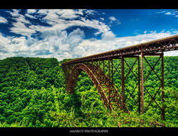
New River Gorge Bridge

Coal Mining
Charleston, WV
1/6

1/1
1/1
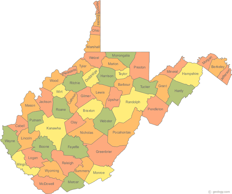
Political Map
"Political maps are designed to show governmental boundaries of countries, states and counties. They can also indicate the location of major cities, and they usually include significant bodies of water."
Click on the picture to enlarge.
Physical Map
"This is a map that focuses on the geography of an area and will often have shaded areas to show mountains or valleys."
Click on the picture to enlarge.
.
Scenery
Take another peek at the beautiful scenery you can find in West Virginia. Click on the picture to view slideshow.
Take A Look At My State!
 |
|---|
 |
 |
 |
 |
 |
 |
bottom of page