top of page


Charleston, WV

New River Gorge Bridge

Coal Mining
Charleston, WV
1/6
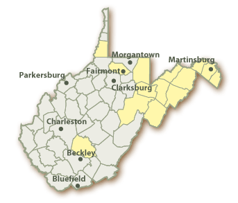


The Cities of Our Great State!
Here is a map of all the major cities in the state of West Virginia. Write down the cities within the picture, and then click the picture to find out the population of each one of the cities listed.
When West Virginia became a state in 1863, the Capitol building was at the Linsly Institute in Wheeling. In 1870, the State Legislature designated Charleston as the Capital city. Today there is a estimated population of about 51,000 people.
Learn more by clicking the picture!
We live in Beckley, WV. Beckley is located within Raleigh County in the southern part of the state. The estimated population is around 17,600 people.
Learn more by clicking the picture!
bottom of page